km1125 wrote: ↑Wed Aug 11, 2021 2:43 pm
As I was watching the radar signatures as the storms rolled across Lake Michigan, I thought it was interesting that when they were leaving the Wisconsin shore, their shape mimicked the shoreline of the state. As they rolled across the lake, it appears they "adjusted" so by the time the made landfall on the Michigan side, they actually mimicked the Michigan shoreline. I don't know what they call that, but how the geography impacts the formation and direction of storms is very interesting. It's very obvious around mountains, but I think it's really interesting how the lakes affect it. I've watched storms roll across the Detroit Metro area and it's interesting what happens to them as they hit the area around Lake St Clair.
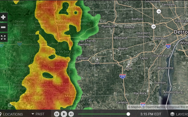
I've also wondered how much this really impacts the storm. I've noticed some storms rolling over the Ann Arbor area and it seems like they split when they go over that valley, with some of the storm trending north and some south. Not that they really GO north and south, just that the development peters out going over the valley instead of strengthening like the areas to the north and south. A couple weeks ago I was in the Bay City area the morning after a bunch of storms rolled though there. Ask a couple people how bad they were and some said "Well, it wasn't too bad. Since we're in a valley they kind of skip over us"
Makes me wonder. If there's a valley, is the influence different if the storm is going over them perpendicular to the valley vs parallel to it? How much of a valley (or a hill) does it take to make an influence to the weather pattern and affect storm development?
EDIT: Here's an example I caught today as the storms were rolling over AA:

Off the top of my head, there are a couple factors at play as mesoscale convective systems (a broad term to describe thunderstorm complexes that are roughy 100 to under 1000 km in horizontal length) move over large bodies of water like the Great Lakes:
1.) Water surface temperatures. Since water has a specific heat capacity of roughly 4000 J/kg, about 4x higher than land, it takes roughly 4x more energy to raise the temperature of the water surface. That's why as you drive towards the beaches in the early summer, the lake breezes are so cool. However, during the fall/winter as cold air masses move into the region, it takes much longer for the lakes to cool off and we get lake effect precip.
In the summer, these relatively cooler water temps create a shallow layer of stability which inhibit storm development. If the atmosphere aloft is unstable (that is, the vertical temperature gradients are steep) and there's a steady supply of warm moist winds in the presence of a lifting mechanism (like a front), the air parcels in these storms airmass originate above the stable surface layer. That's called elevated convection - and this type of convection can still be quite robust. As the storms approach land, they encounter a horizontal thermal gradient once again, which can affect storm circulation.
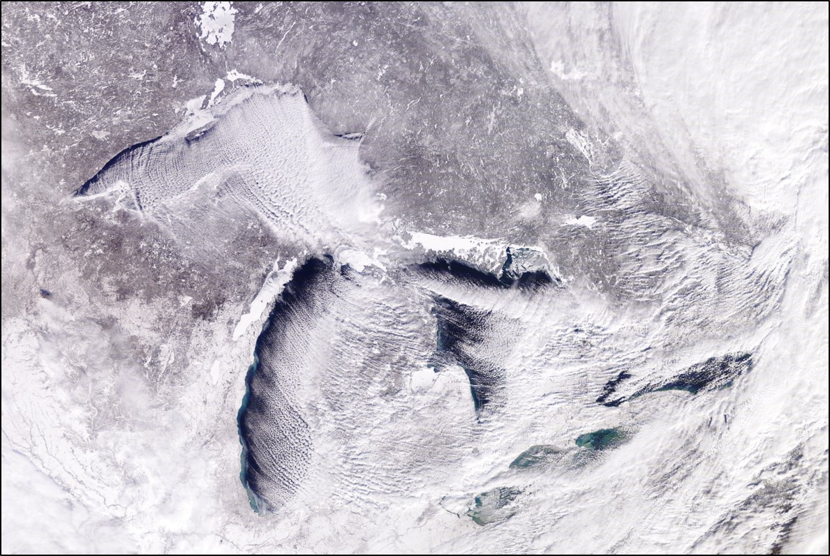
2.) Friction. Just like with automobiles and planes, storms are also shaped by aerodynamic flows. Near the surface (about 1 km and below), there's a bunch of turbulence because of air interacting with trees, buildings, hills, etc. This turbulence slows down air flow, which is why winds at the ground tend to be gusty, but winds aloft tend to be more continuous. We call this turbulent surface region the boundary layer, similar to what you would see in water flows in pipes or rivers. Rough surfaces over land produce more friction than flatter water surfaces. The impacts from friction affect internal storm dynamics. These affects are especially pronounced during lake effect season where you'll see friction lead to sinking air upstream of lake effect precip, and rising air downstream. Example:

I'm here for a good, hearty debate, to agree and disagree respectfully, and commiserate on the current state of terrestrial radio.


