Three things that we will all get is a flash freeze, dangerous windchills, and damaging wind gusts. Both sides of the border have a Winter Storm Warning.
https://weather.gc.ca/city/pages/on-94_metric_e.html
https://weather.gc.ca/city/pages/on-147_metric_e.html
https://www.getprepared.gc.ca/cnt/kts/index-en.aspx
https://www.wunderground.com/
Some registered account users are experiencing password recognition issues. The issue appears to have been triggered by a PHP update last night. If this is occurring, please try logging in and using the "forgot password?" utility. Bear in mind auto-generated password reset emails may appear in your spam folder. If this does not work, please click the "Contact Us" option near the lower right hand corner of the index page to contact me via email.
Thank you for your patience!
- M.W.
Thank you for your patience!
- M.W.
Thu. night - Saturday storm system
Re: Thu. night - Saturday storm system
The forecasts for this storm have varied so much depending on the day and the source. A few days ago, both The Weather Channel and the GFS were saying mostly rain up here where I'm at on the Lake Huron shoreline. Most models though have pushed that rain line further east out over the lake other than maybe some brief rain/mixing at the very start of the event.
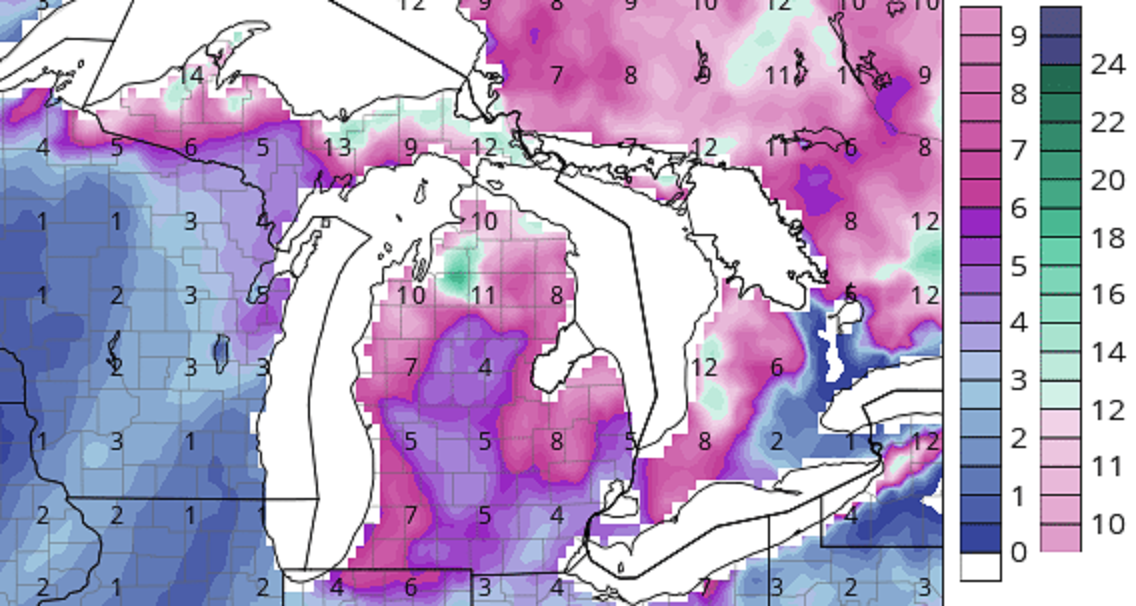
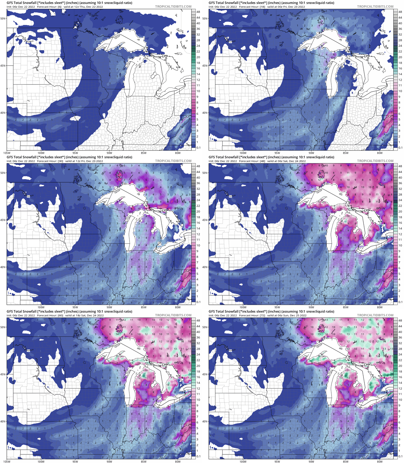
I think the GFS model has a pretty good handle on snowfall totals.

I think the GFS model has a pretty good handle on snowfall totals.

Re: Thu. night - Saturday storm system
Subtract 4 hours from each of the time stamps on the image for EDT.


Re: Thu. night - Saturday storm system
If I'm reading that map right, I think Grand Rapids is just inside the 7-9 inch band.
The reason the models are suggesting lower totals right in the middle of the state (Ionia, St. John's, Mt. Pleasant, and surrounding areas) is because the main snow band is setting up as the low moves from SW to NE along basically I-75 and east. West of that line will get less snow from the main band but the snow belts will get lingering lake effect. That leaves the blob just west of I-75 but east of the main snow belts in the southern half of the state getting less snow from the main band and missing out on much of the lake effect. I think there will be a small area right in the middle of the state that stays in the 4-6 inch range.
The reason the models are suggesting lower totals right in the middle of the state (Ionia, St. John's, Mt. Pleasant, and surrounding areas) is because the main snow band is setting up as the low moves from SW to NE along basically I-75 and east. West of that line will get less snow from the main band but the snow belts will get lingering lake effect. That leaves the blob just west of I-75 but east of the main snow belts in the southern half of the state getting less snow from the main band and missing out on much of the lake effect. I think there will be a small area right in the middle of the state that stays in the 4-6 inch range.
Re: Thu. night - Saturday storm system
Looking at 12-24 in Traverse City with gusts to 55mph. Blizzard Warning... Fun times...
For Kristian Trumpers are not serving our Lord Christ, but their own appetites. By smooth talk and flattery they deceive the minds of naive people.
-Romans 16:18
Posting Content © 2024 TC Talks Holdings LP.
-Romans 16:18
Posting Content © 2024 TC Talks Holdings LP.
- craig11152
- Posts: 2201
- Joined: Tue Nov 06, 2007 8:15 am
- Location: Ann Arbor
Re: Thu. night - Saturday storm system
The NOAA and the Weather Underground are both looking at 2-4 inches in Ann Arbor. That is what I am believing. They both just plain predict the weather. The media outlets seem to "pump" the weather whenever possible.
I no longer directly engage Rate This 
Re: Thu. night - Saturday storm system
Storm continues to speed up and the computer models continue to expand the area that may only get 3 or 4 inches. Pretty much the entire southern half of the lower peninsula, excluding parts of the thumb and the southwest part of the state.

